Hurricane likely is `storm of the year,' expert says
BY JOE NEWMAN, MAYA BELL AND JASON GARCIA
The Orlando Sentinel
ORLANDO, Fla. - (KRT) - Hurricane Jeanne began its brutal march across Florida Saturday, showing no mercy on a state already battered and bruised by three storms in the past six weeks.
Jeanne may be the worst yet - combining the speed of Charley, the size of Frances and the fury of Ivan in one deadly package. Florida has never seen four storms hit in a year.
"It will probably be the storm of the year for the Florida peninsula," said Max Mayfield, director of the National Hurricane Center, near Miami. "It's going to cause extreme damage and loss of life if we're not very, very careful."
The storm was so big that even hours before landfall Saturday, early-evening winds along the coast were toppling small trees, bending street signs in half and ripping tarps from homes damaged during Hurricane Frances.
The best-case scenario for Florida disappeared Saturday afternoon, when Jeanne's forecast track took it inland rather than northward offshore.
Forecasters expected the storm to make landfall around midnight or later between Palm Beach County and Cape Canaveral as a strong Category 3, which has maximum winds of 130 mph.
But because Jeanne will be crossing over the warmer Gulf Stream, they said there was a chance it could intensify to a minimal Category 4.
The nasty weather - high winds, heavy rain and possible tornadoes - should continue to pound the state through all of Sunday.
Residents in St. Lucie and Indian River counties began feeling the effects of the storm by midafternoon.
"They're going to really get clobbered by this hurricane," Mayfield said. "They haven't had a major hurricane in the Fort Pierce-Vero Beach area since 1933."
In Fort Pierce, tropical-storm-force winds arrived by early evening. Street lights and power poles began bending and swaying. Branches, palm fronds and street signs tumbled across roads. Rain fell in a heavy, blinding wall of water.
One Fort Pierce police officer said he saw a mattress blown across a street.
It would be a long night for much of the state.
"We're anticipating nine hours of being battered," said St. Lucie County Administrator Doug Anderson from the county's underground emergency-operations bunker.
That didn't stop many drivers from taking to the roads to sightsee. Nor did it scare many residents of barrier islands into seeking safer ground.
"There are some stubborn people out there that are not leaving the islands," Anderson said. "And they're in danger."
Though millions were ordered to evacuate in advance of the storm, many stayed put - some even taking a matter-of-fact approach to the storm - despite the swath of destruction and death it left in the Carribbean.
"Unfortunately, it looks like the people north of Palm Beach County aren't preparing," said Ed Rappaport, deputy director of the National Hurricane Center, who made an afternoon plea for people to either make last-minute preparations or flee.
"This is stronger than Frances, a well-built storm," Rappaport said. "This is where your life is at risk. If you don't act now, you won't get another chance."
In the barrier islands of southern Brevard County, people remained on the streets as sundown approached. In the small beach town of Indialantic, Katherine Bryan planned to remain throughout the storm.
Bryan said she has never left for a hurricane and wasn't going to start this time. She lives in a subdivision within 200 yards of the beach.
"People can't afford to evacuate this time again. Their credit cards are all maxed out," she said. Almost no one in her subdivision was leaving. She looked out over the beach, sand hitting her in the face and foam flying off the water.
"I'm just trying to enjoy what's left of it," Bryan said.
Floridians know the post-hurricane drill all too well: the lack of power, the fallen trees, the closed stores and restaurants.
This time, however, some people may have to brace for extended power outages. Florida Power & Light warned that customers who lose electricity can expect to be without it for three weeks.
FPL and other power companies are all struggling to find enough workers to handle the impact of Jeanne.
There's also the additional concern of flooding. Jeanne was expected to dump 6 to 12 inches of rain across an already-waterlogged region. Many of Central Florida's rivers, retention ponds and canals are filled to the brim.
Until Saturday morning, it looked like Central Florida might escape the worst of the storm. But the track kept moving westward, encompassing an ever-bigger swath of the state.
Winds of at least 74 mph were expected to spread as far as 100 miles inland.
"If our forecast is right, there will be hurricane-force winds inland," Rappaport said. "There's a pretty good chance they'll make it to Orlando, maybe as far west as Tampa, possibly as far north as Gainesville."
If so, Orlando will have begun feeling hurricane-force winds in the pre-dawn hours, with winds weakening by mid- to late morning. Then they'll be replaced by tropical-storm-force winds of at least 39 mph that could last all day, until the storm moves well to the north, said Bart Hagemeyer, a meteorologist at the National Weather Service in Melbourne.
Damage from inland winds in Central Florida could be worse than it was from Charley, Hagemeyer said. That's because Charley's eye was only 5 miles wide, while Jeanne's eye is about seven times that, which would cast the strongest winds over a much broader area. He also noted that Orlando likely will be on the east - or worst - side of the storm as it traverses the state.
"That's where the worst winds and the worst rains are," Hagemeyer said. "If there is one glimmer of good news, it's that Jeanne is moving much faster than Frances. That may help the rainfall."
Gov. Jeb Bush promised that the state's response to Jeanne would be immediate - but he also urged Floridians to be patient.
"Even though our resources are stretched, we are well-organized to provide relief as quickly as possible," Bush said, conceding that everyone in the state is "weary" of the succession of hurricanes. "Our resources are strained because of the magnitude of these progressive storms ... this is going to be a long term effort to rebuild."
The fact that Jeanne is the fourth hurricane to hit the state this year - and the third to cross Central Florida - is mind-boggling.
Only Texas has been struck by four hurricanes in a single season - way back in 1886. Two of them actually made landfall in Mexico and Louisiana but still hammered the Lone Star State.
"It's historic," Hagemeyer said. "And unfortunately, hurricane season isn't over until the end of November."
---
(Orlando Sentinel correspondents Sean Mussenden and Linda Kleindienst contributed to this report.)
---
© 2004, The Orlando Sentinel (Fla.).
Visit the Sentinel on the World Wide Web at http://www.orlandosentinel.com. On America Online, use keyword: OSO.
Saturday, September 25, 2004
Hurricane Jeanne Lashes Florida's East Coast
Hurricane Jeanne Lashes Florida's East Coast

The U.S. National Hurricane Center said the storm, now a strong Category 3 on the five-step Saffir-Simpson scale of hurricane intensity, could strengthen further over warm water between the Bahamas and the southeastern United States.
State officials said computer models showed 4.7 million of the state's 17 million people were in harm's way, and estimated that 1.2 million buildings could be damaged, leaving around 142,000 families without homes.
Florida Power and Light Co. said 12,000 of its customers were without electricity. The utility appealed nationwide for more linemen and tree-cutters to supplement the crews still repairing damage from the last hurricanes.
"Our resources are clearly stretched," FPL President Armando Olivera said. "In all candor we must tell our customers that they must be prepared for extended outages, perhaps three weeks or more."
When Jeanne comes ashore, it will mark the first time since records began in 1851 that Florida has been walloped by four hurricanes in a single season. The season lasts from June to the end of November.
In the Bahamas, residents of Grand Bahama and Great Abaco islands, both still recovering from the ravages of Frances, packed into shelters.
On Great Abaco, Jeanne felled trees and power lines, destroyed one house and tore the roofs off several others. Rising water submerged roads and flooded two shantytowns full of Haitian immigrants, many of them illegal aliens who resisted moving to government shelters.
Torrential rains lashed Grand Bahama Island. The center of the storm was expected to pass north of Freeport, where most of the island's 50,000 residents live.
"The warm waters of the Bahamas are fueling the storm," meteorologist Basil Dean said. "Grand Bahama will be under the gun for several hours."
In Florida, Hurricane Charley kicked off the season of misery when it slammed ashore on the southwest Gulf Coast on Aug. 13. It killed 33 people and caused $7.4 billion in insured damages.
Frances hit the Atlantic coast on Sept. 5, killing 30 and causing $4.4 billion in damages.
Ivan ripped into the Gulf Coast between Florida and Alabama with 130 mph winds on Sept. 16, killing at least 45 people across the United States and causing up to $6 billion in damages.
Please remember Ward and Melanie Shaklee in Melbourne, Fl. and Neice Cortney in your prayers...
Good source for hurricane information.. lots of links..
Drudge Report... as of this hour, 9:30PM Sat.. Florida is getting hit and there has been tornadoes at Cape Kennedy.. not far from Ward's... and Melbourne is getting hit now with 115 mile per hour winds.. and the eye is about an hour away yet... These folks need our prayers and after the storm, they might need our support as we can... Please Ward and family, please, when you get a chance, let us know how you guys are doing and what we can do to help you guys.... please??? YOU are all in our prayers that God will hold you in his palm and keep you safe... and give you strength... be safe!
Drudge Report... as of this hour, 9:30PM Sat.. Florida is getting hit and there has been tornadoes at Cape Kennedy.. not far from Ward's... and Melbourne is getting hit now with 115 mile per hour winds.. and the eye is about an hour away yet... These folks need our prayers and after the storm, they might need our support as we can... Please Ward and family, please, when you get a chance, let us know how you guys are doing and what we can do to help you guys.... please??? YOU are all in our prayers that God will hold you in his palm and keep you safe... and give you strength... be safe!
The ole "Hoopie" dad talked about often....

The one picture that did not make it into the pics for Dad's photojam.. some day I will fix that, I hope.
Dad and Carlyle Troubant went to Galveston, TX in this ole Hoopie.. from Okarche, OK. for a bit of a Senior trip, in 1937, when Dad was 19. His father died later that Fall I believe. Carl was the son of a preacher at Mt. Zion United Brethren Church at El Reno, and he and Dad were life long friends. The trip to Galveston was 550 miles via interstate highways.. not sure how much longer via old roads, and if you notice.. there was NO top! No protection from the rain, sun, other cars, etc! And I can still remember so clearly him telling about this big event in his life... two guys, open car, open road, sunburn, headaches, windblown, distance, etc.... I am sure that besides the marriage to my mom... this was like ... second in his memory collection!!! Usually about once a year we heard of this.. one year, Cousin Leon and wife Nita went to lake with her parents and Leon came home so sunburned he had to go to the field in a dress to plow... cause jeans hurt so bad to put on.. oh yes, I remember... the stories... life's foundation! Enjoy..
(photo by stan click to enlarge)
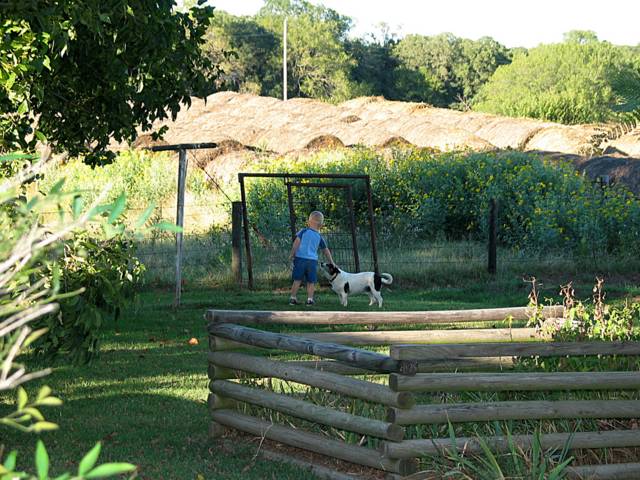
Was peaking out the front door watching Andrew... and Spot last night. We had all gathered at Great Grandma Moffat's for Pizza and to write Thank You's, and read the awesome cards she received.. Andrew wanted to play, and he is an OUTDOOR boy.. so out he went. I have captured the moment I think. There are many more from last evening, including one of "Mom" closeup I think is awesome.. but more on that later. Everyone is getting ready today to head to Jonathan and Randi's "sort of" shower in Stratford this afternoon, and then head on down to Jon's to mess around a bit and keep them from resting afterward.. haha... More on that later, but the granddaughter is progressing right on schedule... oh boy.. can not wait.. ~~
(photo by stan click to enlarge)
Subscribe to:
Posts (Atom)